GPR, the high-tech tool in Masjid India sinkhole search: What is it and how can it help?

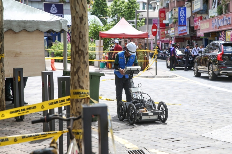
A representative from the Department of Mineral and Geoscience Malaysia is seen wheeling a ground penetrating radar (GPR) device at the Jalan Masjid India in Kuala Lumpur August 28, 2024. — Picture by Yusof Mat Isa
Wednesday, 28 Aug 2024 2:03 PM MYT
KUALA LUMPUR, Aug 28 — A high-tech piece of equipment has been brought out to help locate missing Indian tourist Vijayaletchumy, 48, on Day 6 of her disappearance when the pavement caved beneath her feet along Jalan Masjid India here last Friday.
The Ground Penetrating Radar (GPR) was also employed during the Gohtong Jaya landslide in 2022, and has proven indispensable in locating people underground.
Here we highlight what GPR is and how it will be used to help SAR personnel during the operation.

A representative from the Department of Mineral and Geoscience Malaysia is seen wheeling a ground penetrating radar (GPR) device at the Jalan Masjid India in Kuala Lumpur August 28, 2024. — Picture by Yusof Mat Isa
What is Ground Penetrating Radar and how does it work?
It is an advanced geophysical technique designed to probe the subsurface of the earth.
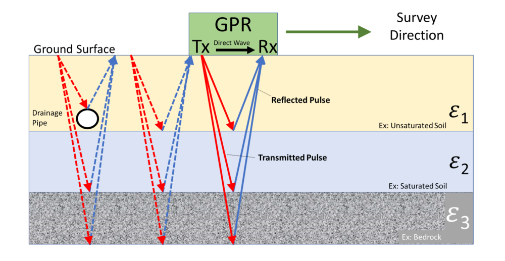
By utilising electromagnetic theory, GPR emits high-frequency radio waves into the ground through a transmitter antenna.
These waves travel through various materials and are reflected back when they hit different interfaces, such as voids or changes in material density.
A receiver antenna then captures these reflected signals, which are used to generate a detailed image of the subsurface.

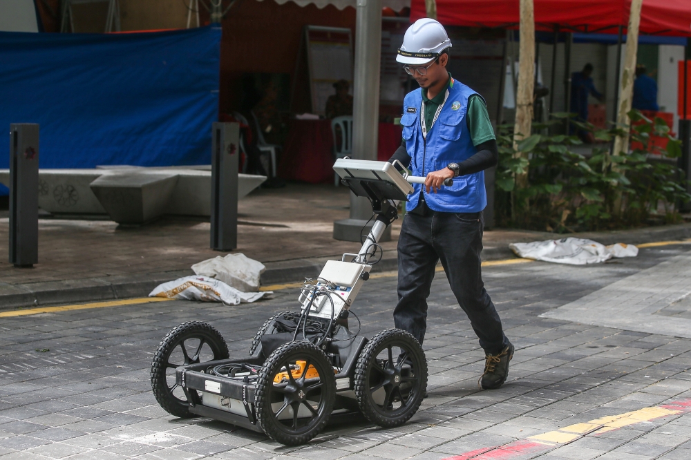
The Ground Penetrating Radar device being used for the land integrity assessment around the Jalan Masjid India sinkhole. — Bernama pic
How is GPR used in the KL sinkhole rescue?
First, it maps the extent of the damage below the surface, helping rescue teams plan their operations more effectively. By revealing the scope of subsurface damage, GPR allows for a strategic approach to the rescue mission.
Second, GPR identifies potential hazards by detecting changes in subsurface composition and locating underground cavities that could pose additional risks. This information is crucial for avoiding areas prone to further collapse and ensuring the safety of rescue personnel.
Third, during rescue efforts, GPR aids in locating trapped individuals. By pinpointing voids and changes in material density, the radar helps rescuers identify where people may be buried, thereby improving the efficiency and effectiveness of their efforts.
Finally, after the immediate rescue operation, GPR is used to assess the full impact of the sinkhole. This post-incident analysis is essential for planning repairs and reinforcing the affected area to prevent future occurrences.
Kuala Lumpur City Hall said the land integrity assessment along the sewerage channel on Jalan Masjid India, related to the recent sinkhole incident, is expected to be completed today.

Reflected waves penetrating the subsurface travel at different velocities based on the dielectric permittivity (ε) of the media in which they encounter. All subsurface anomalies, such as the draining pipe, are observed by the GPR. The progression of the survey is represented by dashed lines. — Schematic diagram of a GPR survey taken from the US Environmental Protection Agency website
Where else is GPR used?
GPR is a versatile tool with several critical applications.
In archaeology, it helps locate buried artefacts and structures without disturbing the site.
In civil engineering, it is used to inspect infrastructure like roads and bridges for hidden issues such as voids and cracks.
Environmental studies benefit from GPR’s ability to map contamination and assess groundwater resources.
Most importantly, in search and rescue operations, especially during emergencies like sinkholes, GPR plays a vital role in locating trapped individuals and understanding the extent of subsurface damage.
According to the United States Environmental Protection Agency, GPR method has been successfully used as an investigative tool applied to hydrogeological, environmental, engineering, and archaeological studies to aid the following:
- Mapping bedrock configuration and depth
- Identifying karst features, voids, and burrows
- Locating pipes, tanks, and other utilities
- Delineating soil horizons and soil stratigraphy
- Determining ice thickness
- Locating the groundwater surface
- Determining water depth in lakes
- Mapping fractures, changes of rock type, and rock fabrics
- Identifying and mapping the extent of groundwater contamination
- Detecting unexploded ordinance and unmarked graves
- Studying moisture/gas dynamics in soils
- Locating lava tubes
- Monitoring tree root distribution and health
Recommended reading:
The Bomoh is more widely trusted
ReplyDelete